

Master of Fine Arts in Design Development from The Ohio State University's Department of Industrial, Interior, and Visual Communication Design under the advisement of
Academic Depth & Comprehensive Research: As an MFA thesis, it signifies rigorous academic work, detailed documentation (72 pages), and a thorough exploration of the subject, including a UX framework and a visual design language.
Strategic & Scalable Approach: The project's goal to create "guidelines for how to recreate such a system for a different geographic area" and "apply this system on a larger scale" highlights a forward-thinking and broadly applicable design strategy.
User-Centric Problem Solving: It addresses the practical need for intuitive "visual wayfinding" on mobile devices, providing a solution with the intention of "seamless integration" for city wayfinding systems.
Contextual Understanding & Foresight: The inclusion of an infographic on the "Evolution of the Use of Global Positioning System (GPS) Technology" demonstrates a strong understanding of the technological landscape and the historical context, which was particularly relevant for a mobile wayfinding project in 2007.
Diverse & Tangible Deliverables: The project produced a range of outputs, including animated and interactive demonstrations, a detailed design strategy, concept development, and prototypes, showcasing a complete and well-executed design process.
Roles: information architecture, usability testing, interaction design, documentation, prototyping.
Infographic describing the evolution of GPS navigation.

User flow diagram

Usability test plan
Usability survey
Usability test report findings

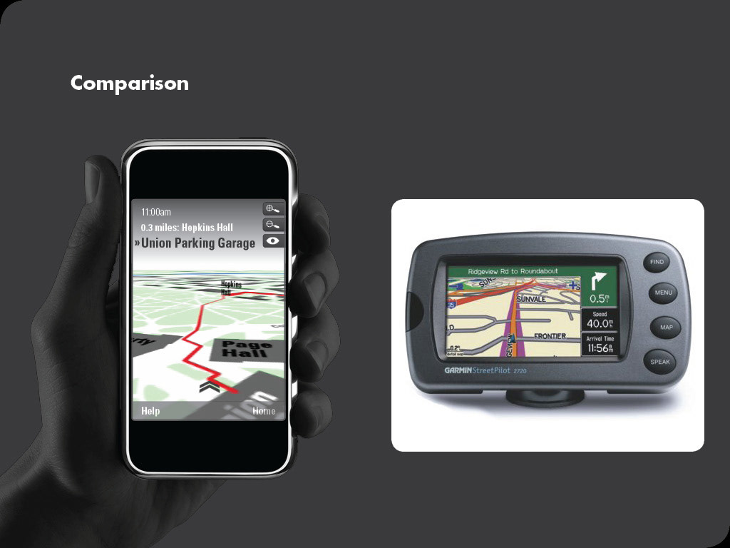
Slide from presentation demonstrating the visual hierarchy in my solution (left) compared to an existing system.
Full project documentation including survey analysis, competitive audit, technical specifications, and guidelines.